Canals are part of what is called the ‘internal drainage’. There are 2 major canals on the Flats known as ‘G Canal’ and ‘K Canal’. G Canal is the major point of drainage for hill water and the southern part of the Flats. It merges into the Awaroa Creek to drain into the Kaipara Harbour. K Canal is the major drainage source for the northern part of the system and joins up to the Naumai Creek to drain into the Northern Wairoa River. Approximately 45km of internal stopbanks run along the length of these canals as they are tidal and this prevents large tides from travelling inland and overtopping into paddocks.

Southern end of G Canal/Awaroa Creek
These are also part of the internal drainage. Across the Ruawai Flats is a system of drains of various sizes which direct water either into a canal or directly into the river/harbour to be discharged from the drainage system. The internal drainage system is divided into 4 areas and the water from each area is kept separate. This is to try and prevent flooding that may happen in one area from impacting another area. There are 137.6km of drains and canals in the drainage system. Regular clearing is needed to prevent drains from becoming clogged with weeds which reduces the efficiency of the drainage system.

A drain on the Ruawai Flats
The Ruawai Flats has 72km of stopbanks. These run from the base of the hills at Te Kowhai in the south to Donovan’s Bluff in the north and along the length of the two tidal canals. These stopbanks prevent tidal water from the Kaipara Harbour being able to wash over the low-lying flats and/or to contain the Northern Wairoa River when it is in flood.
The stopbank height currently varies from 2.8m to 4.0m, the design height for the system is 3.2m. The outer side of the stopbank that fronts the river and harbour south of Ruawai township is covered with stone to prevent erosion. Over the last 15 years the Raupo Drainage Committee have been undertaking annual stopbank remediation works, widening and raising the main stopbank to a height of 3.8 to 4.0 metres.

Section of stopbank south of Ruawai Township
The drainage network includes one 50 horsepower storm pump, located at the end of Wallace Road, that is used to improve the movement of water from a major drain into G Canal during storm events.
At points where some drains reach their discharge point are floodgates. There are 52 floodgates in the Raupo Drainage Scheme. Floodgates are designed to prevent water from being able to move backward through the drainage system. They are designed so that as the incoming tide creates pressure on the gate it is pushed closed to prevent water from passing through. As the tide goes out, the gates can once again open and water from the drains and canals can flow out of the system again. During a rain event water will often build up in drains during the high tide when the gates are closed but then flow out and drain flooding once the tide recedes and the gates open. The floodgates are of varying size and construction depending on their location.

Floodgate next to Ruawai Wharf
The Raupo Drainage Scheme is administered by the Raupo Drainage Committee. The Raupo Drainage Committee is the longest serving committee in the Kaipara district, and was formally known as the Raupo Drainage Board before the 1989 local government amalgamations when it was absorbed into the Kaipara District Council to become a co-governance committee. .
Over the years its role and responsibilities have varied, but its main functions are to govern the Raupo Drainage District, advise Council in drainage matters and act as a voice for Raupo ratepayers.
Both Councillors and ratepayers from within the Raupo Drainage District sit on the Committee, working co-operatively for the District. The ratepayer representatives on the Committee are elected every three years.

A floodgate built into the stopbank where it intersects with a major drain.
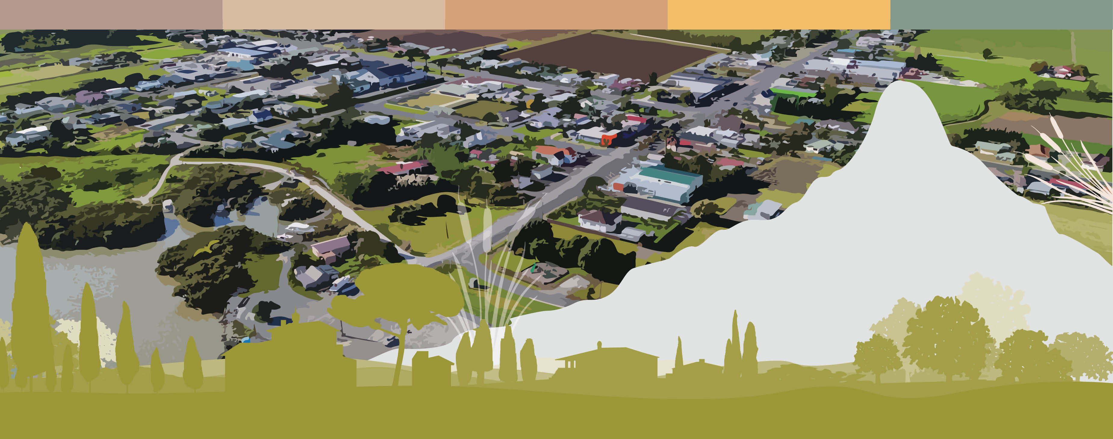
The Ruawai Flats are situated on a former swamp. They are low lying, coastal and surrounded by hills, therefore, the area is vulnerable to flooding events. The Raupo Drainage Scheme plays a vital role in reducing the risk of flood events on the Ruawai Flats.
The Ruawai Flats needs to be protected from two different forms of flooding
This protection is carried out through a complex system of stopbanks, canals, drains and floodgates.

Map of the Raupo Drainage Scheme